James Buchanan (Buck) Coffman was born 28 Jan 1857 and died 8 Jan 1935; he is buried in Point Pleasant Cemetery, Ohio County.
Saturday, December 29, 2018
Wednesday, December 26, 2018
Tobacco census 1910 - William S. Carter
William Silas Carter was born 14 Feb 1876 and was a farmer in the Centertown area of Ohio County. He never married and died 17 Mar 1947 at age 71. He is buried in Waltons Creek Church Cemetery in Centertown.
Saturday, December 22, 2018
Wednesday, December 19, 2018
Saturday, December 15, 2018
Tobacco census 1910 - Calvin C. Borah
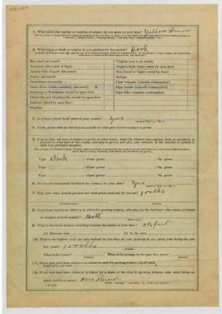
In August 1910 the Federal government collected data about the production of tobacco in the various states. A form was mailed to individuals and was filled out and returned to the Census Bureau. I found that fourteen people from Ohio County returned a tobacco census form. Unfortunately the quality of these documents is not very good, some of the hand writing is hard to read, and the information contained in the documents is not earth-shaking but, none-the-less, it might be important to a descendant. I will post them in alphabetical order - the first is Calvin C. Borah.
Calvin Borah was born in 1845 so at the time he filled out this form he was 65 years old. The regular census for 1910 says he lived in Cromwell and was a timber dealer. Calvin lived until 1930. Page one above says that he leased the property where he had a tobacco crop (tenant).
Wednesday, December 12, 2018
Owen Hunter and Oppie Kittinger
This is a photo of Owen Hunter (center in overalls) and Oppie Kittinger (left) with cigars. The man on the right is unidentified. Hunter and Kittinger were related by marriage. The photo was taken at Livermore or Hartford during 1910 - 1920. The photo was contributed to the Kentucky Historical Society by Carmen Kittinger.
Saturday, December 8, 2018
John P. C. Porter
I have only found one Porter family in the 1840 census for Ohio County - it looks like the father was named Oliver or Elvira Porter (probably Oliver Cromwell Porter 1784-1858). I think this is correct and I think the son shown in the above chart was John Philpot Curran Porter born about 1824 (chart says he is 19 years old, so that would be 1821 or so.
Wednesday, December 5, 2018
Stateler Memorial Methodist Church
Saturday, December 1, 2018
1940 Census Maps
The 1940 census maps might help you find
where your ancestors lived and what church, school or cemetery was nearby. Ohio County
When
you find your ancestor listed on the census sheets you will see that the far left column is for the name
of the street or road they lived on and the next column is for their street
number. Of course in rural areas street numbers were not used in 1940. If
nothing is shown for location then the person that prepared the document failed
to fill it out completely, which is often the case. In the upper right of each
page the Enumeration District is shown, which corresponds to the maps. Each
page is dated and signed by the person that took the census. If you are
lucky your ancestor is listed on line 4 or 40 - if so, look at the
supplementary information at the bottom of the page. So, find your ancestor and then use the maps to try to pin-point their location and see what was nearby. If you are a member of Ancestry.com you can see these same maps and those maps may have better detail for viewing on your computer.
Here are the six maps that show all of the 23 enumeration districts:
Subscribe to:
Posts (Atom)


